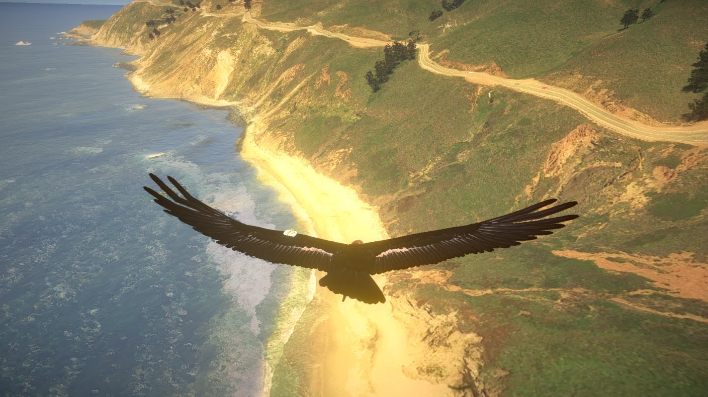
In this interactive project for California State Parks installed at Julia Pfeiffer Burns State Park (JPBSP), the visitor uses their outstretched arms to soar as a California Condor above Big Sur. The visitors use their bodies to bank, dive and lift in virtual 3D space as they follow flight paths from actual California Condors.
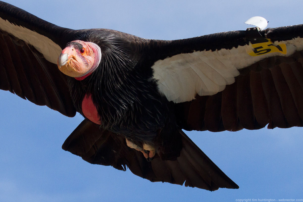
Our main goal is to convey condors’ unique long-range gliding: not simply to show their amazing glide ratio, but also to emphasize how their highly adapted vision and specialized wings allow them to travel enormous distances without flapping. We begin on the wing and we encourage visitors to follow the actual condor paths provided by Ventana Wildlife Society, a project partner who also hosts a second interactive for visitors to use in their center.
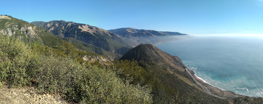
Below are a selection of condor flights paths sourced from the telemetry data provided by the Ventana Wildlife Society. We chose actual flights that represent a range of altitudes and regions, including the area above the JFBSP center where visitors can use the interactive, the coast between Andrew Molera State Park and nearby McWay Cove, as well as the Pt. Sur area.
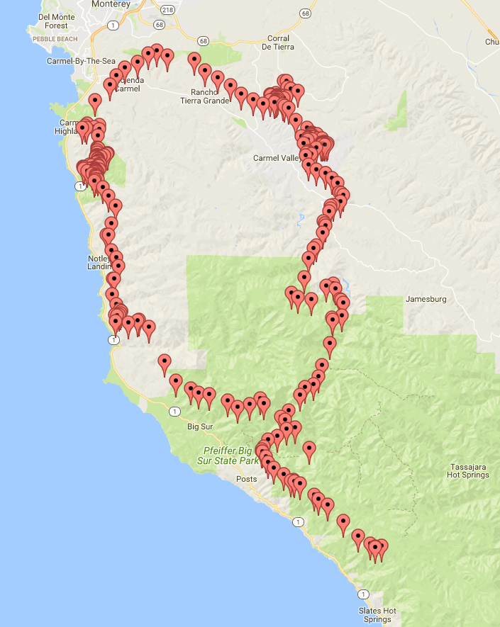
Condors at the coast mainly ride the updraft from the cliffs. In the below image, note the condors’ use of ridge lift along the Pacific coast, as well as their ability to seek out areas where heated terrain creates rising columns of air called thermals.
This combination of flight modes enables condors to cross vast distances. Below, in around an hour, we track a condor along the coast and inland to the Pinnacles region, then back to complete a circular path. In the interactive, visitors can switch to an infrared view to illustrate how condors can see warm masses of air in the landscape.

From our work on the Monterey Bay Aquarium Seabirds project, we learned that it’s best to pare away any interactions that may draw the visitor’s attention away from the main points we’d like people to understand.
In the renderings of the flight experience shown at right, note the accurate topography of the area. The extensive 3D tree placement draws on a general classification of environments (annual grasslands, redwood forest, et cetera) is available from Monterey County, California, along with William Critchfield’s presentation ofmany useful cross-sections of topography showing tree species (Dept. of Agriculture, Forest Service).